|
|
NGDC Declination |
|
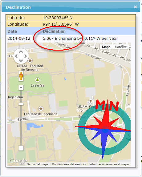
Date: 2014-09-12
Latitude: 19° 19′ 48.8958″ N
Longitude: 99° 11′ 5.8596″ W
Elevation: 0.0 km
Model Used: WMM 2010
Declination: 5° 3′ 40″ E changing by 6.7′ W per year |
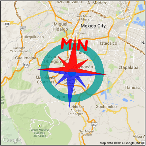
Compass shows the approximate bearing of the magnetic north (MN) |
|
Magnetic declination is the angle between true north and the horizontal trace of the local magnetic field. In general, the present day field models such as the IGRF and World Magnetic Model (WMM) are accurate to within 30 minutes of arc for the declination. However, local anomalies exceeding 10 degrees, although rare, do exist. Document created: 2014-09-12 09:48 UTC Questions: geomag.models@noaa.gov |
|

Como obtener el dato:
Alberca en Google maps. https://www.google.com.mx/maps/@19.3302487,-99.1849611,19z?hl=es
Convertir decimal a grados: https://support.google.com/maps/answer/18539?hl=es
Calcular declinación segpun la NOAA: http://www.ngdc.noaa.gov/geomag-web/#declination
No era necesario convertirlo a grdos, también trabaja en decimal: